News | The Esri User Conference: A Student Perspective
Stop the VideoNews
by By Rui Zhang, USC Price MPL, Transportation, 2018
Environmental Systems Research Institute (Esri, formerly ESRI), an international supplier of Geographical Information System (GIS) applications, held its 37th annual User Conference (UC) From July 10 to 14, 2017 at the San Diego Convention Center, where GIS scholars and practitioners across the globe gathered to present and exchange information on cutting-edge developments of geographical information science.
This conference is the world's largest event dedicated to GIS technology and attracts students and professionals representing numerous technologies and backgrounds; this year, conference attendance grew to just under 18,000 attendees. And I was fortunate to be one of those attendees.
The conference offers multiple workshops, a large GIS product expo and a map gallery. Hundreds of of 30 to 45 minute workshops run from 7 am to 6 pm every day, inviting world- renowned GIS talent to offer training on GIS skills, show updated software or web applications in industries specific for different fields, and interact with the audience on most recent processes of GIS study theories and methods.
I was impressed with the updates on 3D GIS, and fascinated to learn about the massive breakthrough of virtual reality (VR) integrating GIS models, augmented reality (AR) which supported the huge success of Pokemon Go, and mixed reality (MR) which combine the two. The Esri Zurich team plays a leading role in this development field and has higher expectations for AR versus VR, because from the point of practical purpose, VR weighs more for entertainment while AR is projected to greatly promote the interaction between users and real surroundings.
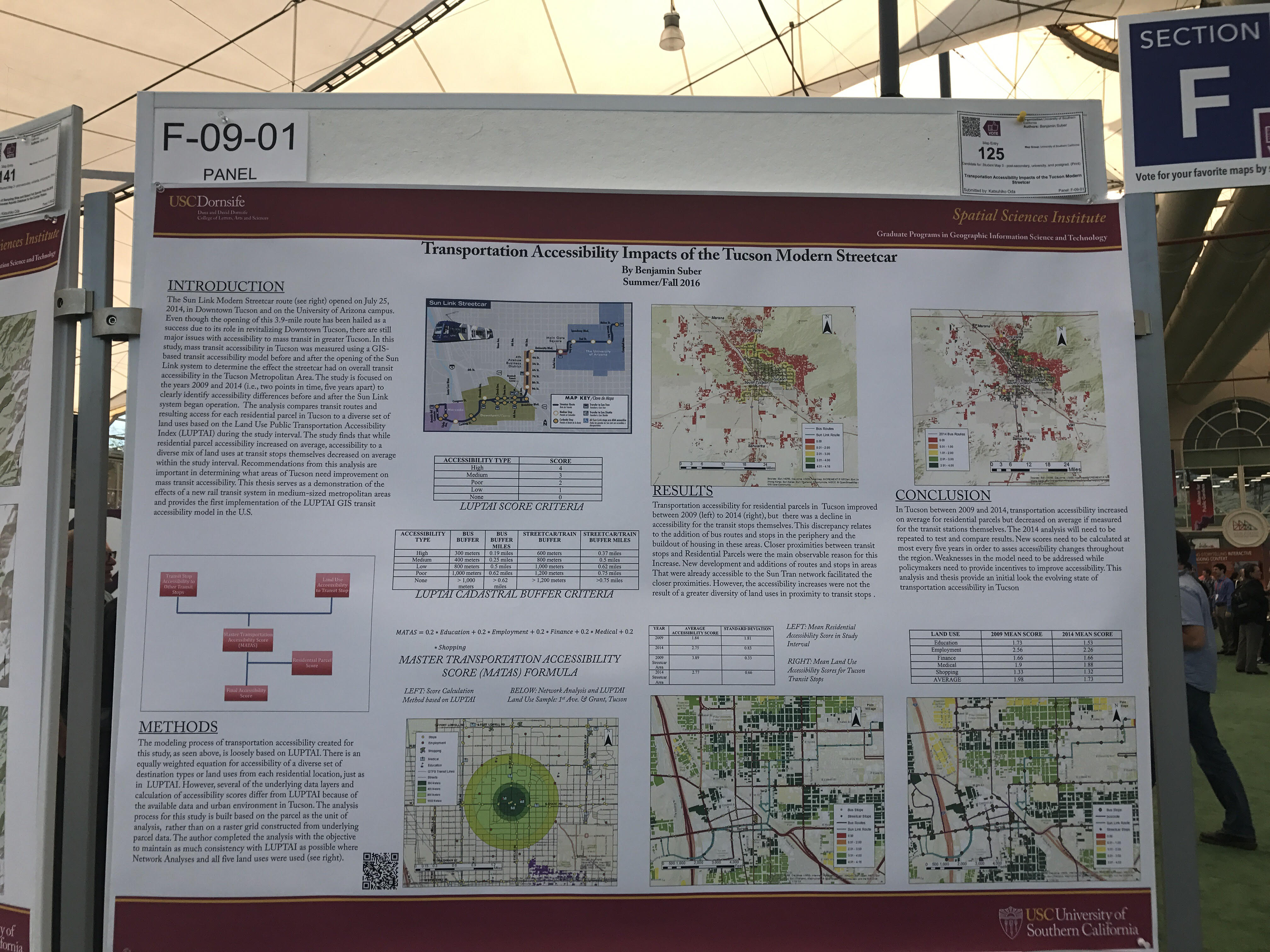
Poster by USC Spatial Science Institute at Map Gallery
Photo by Rui Zhang
The expo also gathered the top GIS product developers, experienced companies such as SAP SE, as well as young start-ups which use and develop innovative analysis methods. A 4D VR flying device produced by Modelworks attracted everyone’s attention – setting users in the model of flying in the air of New York. Users can control the rotating degrees, flying speed and directions through the wind. A fan at the head can generate wind to make the feeling of motion real.
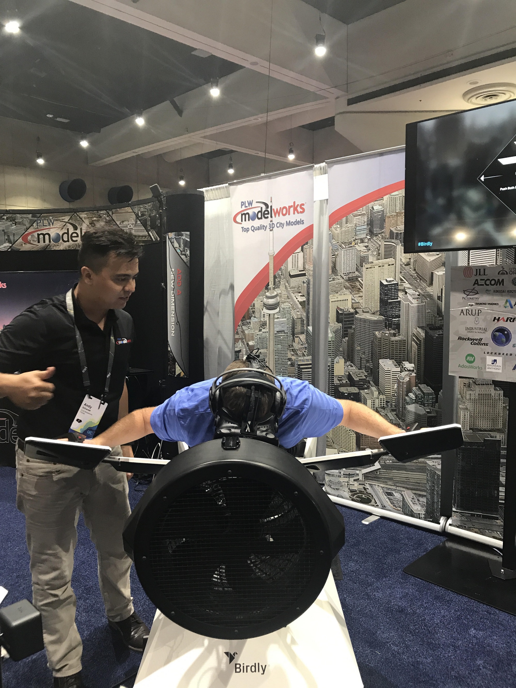
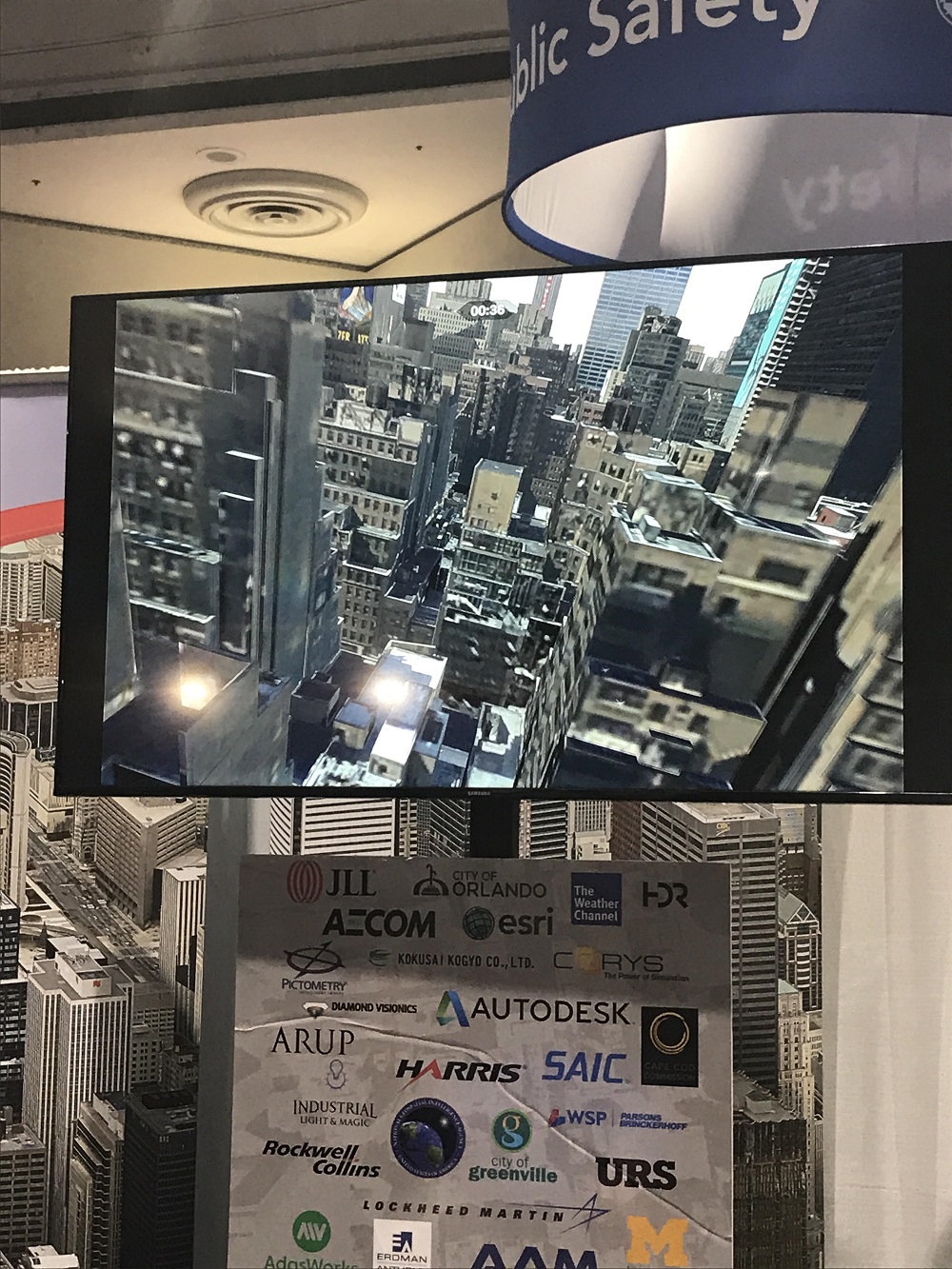
4D VR Device Setting Users to Fly in the Air of New York City User’s view in the VR Model
Photo by Rui Zhang
The map galleries inluded GIS study posters submitted by students, scholars, and practitioners across the world. The topics ranged from public safety, to wildlife conservation, to transportation assets, to housing issues and more. The Esri Zurich team shared a huge map wall for the blind. Prominent curves accompanied with braille scripted words brought the map alive for the vision impaired, conveying information by touch instead of sight. Audiences gave high ratings to this innovative and, for many, life-changing product. Unfortunately, such tactile maps at affordable price are not yet available in market. But, they hope that they soon will be, and that they have demonstrated a way for map developers to serve more than the sighted population.
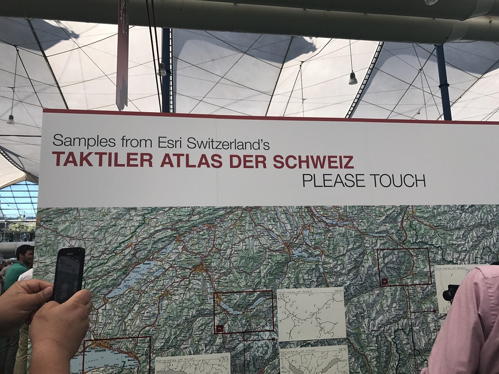
Tactile map for blind from Esri Zurich
Photo by Rui Zhang
“I feel so honored to gather together with all the map lovers across the world,” reflected attendee Aaron Su, who earned a Bachelor of Science in GIS and Cartography from Wuhan University, and recently completed a dual Master’s degree in Urban, Community, and Regional Planning and in Geographic Information Science and Cartography at the University of Pennsylvania. “All the developments in the field of applied geography really opened my mind. Esri really provides a fantastic opportunity to connect the schools to the industry, from which I can know how the world is promoted with GIS.”
About the Author
Rui Zhang is a second-year Master of Planning student at USC Price School specializing in transportation. She the Publisher and Editor in Chief of the METRANS student newsletter, METRANS on the Move, is interning at Foothill Transit, and is a METRANS Research Assistant working on Caltrans funded project, “Managing the Impacts of Freight in California.” She plans to pursue a career as a transit planner, and can be reached at [email protected].
News Archive
- December (1)
- November (6)
- October (4)
- September (2)
- August (3)
- July (4)
- June (3)
- May (7)
- April (8)
- March (11)
- February (8)
- January (7)
- December (7)
- November (8)
- October (11)
- September (11)
- August (4)
- July (10)
- June (9)
- May (2)
- April (12)
- March (8)
- February (7)
- January (11)
- December (11)
- November (5)
- October (16)
- September (7)
- August (5)
- July (13)
- June (5)
- May (5)
- April (7)
- March (5)
- February (3)
- January (4)
- December (4)
- November (5)
- October (5)
- September (4)
- August (4)
- July (6)
- June (8)
- May (4)
- April (6)
- March (6)
- February (7)
- January (7)
- December (8)
- November (8)
- October (8)
- September (15)
- August (5)
- July (6)
- June (7)
- May (5)
- April (8)
- March (7)
- February (10)
- January (12)
2024
2023
2022
2021
2020
2019
2018
2017
2016
2015
2014
2013
2012
2011
2010
Major Funders


Metrans Associate Partners